Old Mill Village Launch Area – The Pound River
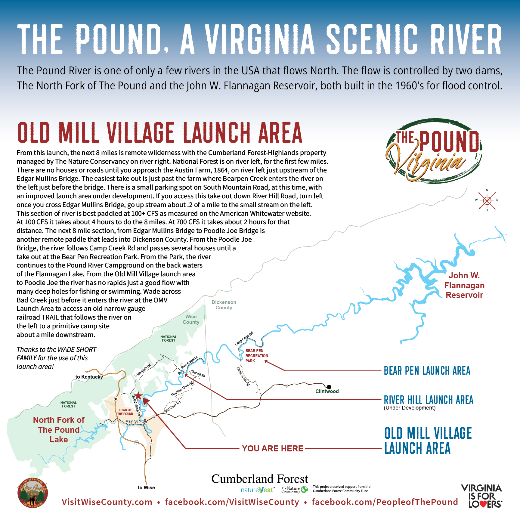
The Pound, A Virginia Scenic River
The Pound River is one of only a few rivers in the USA that flows North. The flow is controlled by two dams, The North Fork of The Pound and the John W. Flannagan Reservoir, both built in the 1960’s for flood control.
Old Mill Village Launch Area
From this launch, the next 8 miles is remote wilderness with the Cumberland Forest-Highlands property managed by The Nature Conservancy on river right. National Forest is on river left, for the first few miles. There are no houses or roads until you approach the Austin Farm, 1864, on river left just upstream of the Edgar Mullins Bridge. The easiest take out is just past the farm where Bear Pen Creek enters the river on the left just before the bridge. There is a small parking spot on South Mountain Road, at this time, with an improved launch area under development. If you access this take out down River Hill Road, turn left once you cross Edgar Mullins Bridge, go up stream about 0.2 of a mile to the small stream on the left. This section of river is best paddled at 100+ CFS as measured on the American Whitewater website. At 100 CFS it takes about 4 hours to do the 8 miles. At 700 CFS, it takes about 2 hours for that distance. The next 8 mile section, from Edgar Mullins Bridge, the river follows Camp Creek Rd and passes several houses until a take out at Bear Pen Recreation Park. From the Park, the river continues to the Pound River Campground on the back waters of the Flannagan Lake. From the Old Mill Village launch area to Poodle Joe, the river has no rapids, just a good flow with many deep holes for fishing or swimming. Wade across Bad Creek just before it enters the river at the OMV Launch Area to access old narrow gauge railroad trail that follows the river on the left to a primitive camp site about a mile downstream.
*Thanks to the Wade Short Family for the use of this launch area!